The latest forecast data is starting to show a weather pattern shift, bringing lower temperatures and also snowfall in the second half of the month. This is the first winter-like pattern of the season, impacting the central and eastern United States, Canada, and parts of western and central Europe.
A low-pressure area is forecast to develop over the eastern United States later next week and last into late next month. Such a winter pattern would bring proper cold winter weather to the U.S. but there are some limitations, as we are in November instead of January.
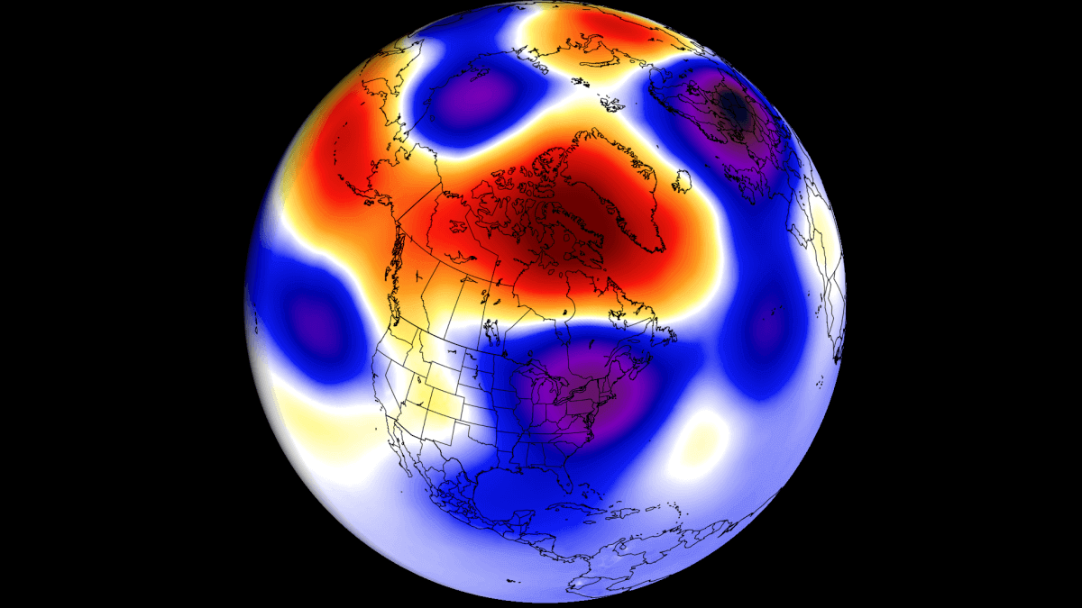
The image below shows one of the upcoming patterns, with a low-pressure area over the eastern United States, bringing lower temperatures and also snowfall over parts of the United States.
WEATHER THIS MONTH
November is the last month of the meteorological Autumn. It is usually the transition period into a stronger winter circulation over the Northern Hemisphere.
So, looking at the pressure pattern for the first third of November, we can see a high-pressure area over the central and eastern United States. This brought very mild and unseasonably warm weather for this time of year.
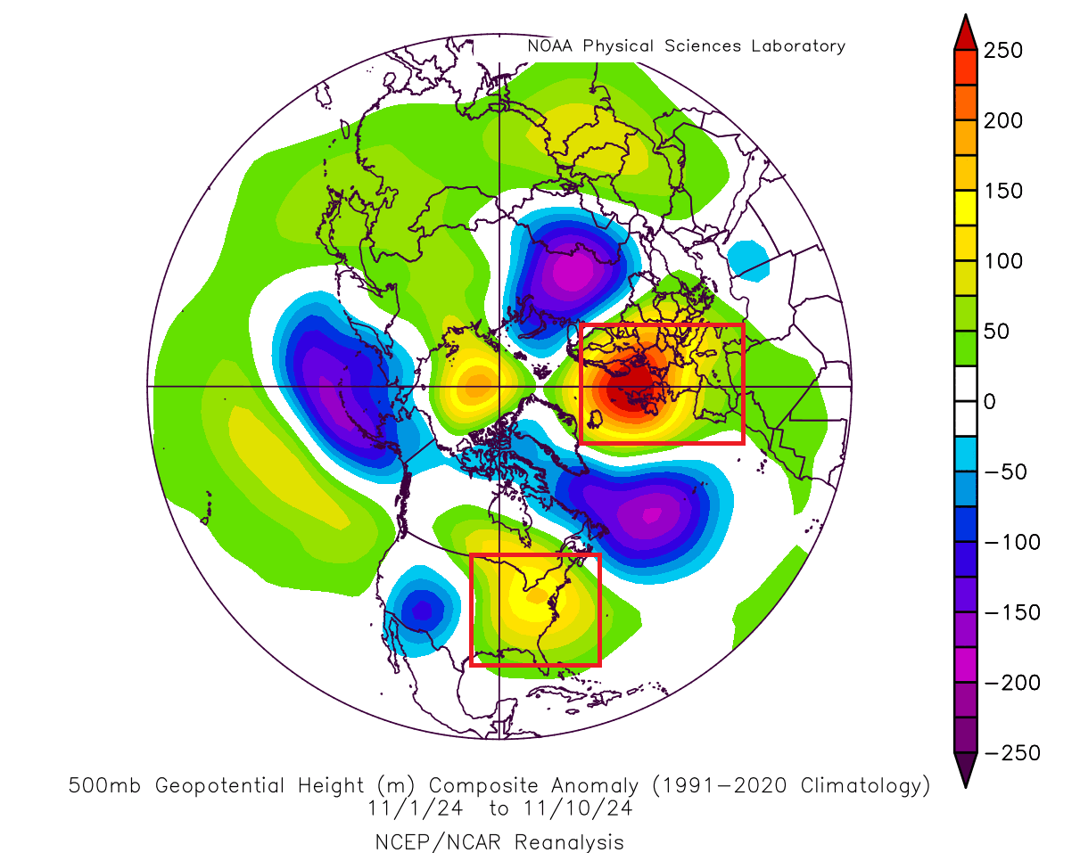
The reason we showed you this weather pattern analysis is because the expected weather shift in the next two weeks will bring completely opposite anomalies.
Looking at the next few days, we can see little change in the pressure pattern. The high-pressure anomaly is still present over the eastern United States and Canada. Low-pressure areas are spinning around it, most notable over the western United States.
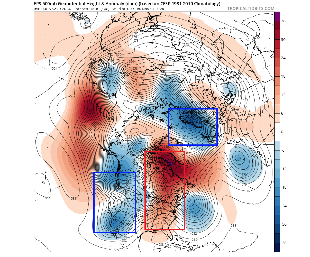
This configuration fits nicely in the overall progression into a more winter-like pattern, as the high-pressure area is lifting from the eastern United States into a Greenland blocking.
Looking at the temperature anomaly for this period, you can see continued warmth over the eastern half of the United States and southern Canada. The only area with below-normal temperatures is found over the southwestern United States, under the influence of a low-pressure system.
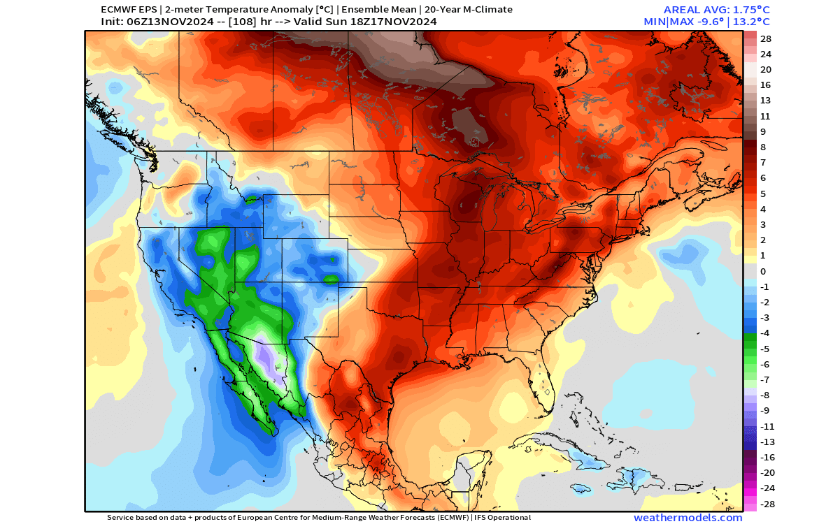
Over Europe, most of the continent is warmer than normal, except the far northwest and the central parts.
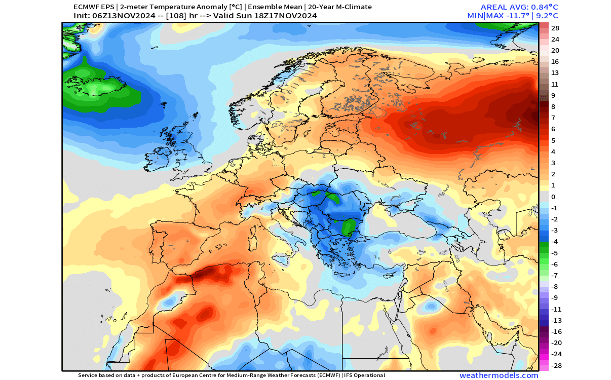
But a bigger weather change is coming in the following week over the Northern Hemisphere.
A WINTER CHANGE ON THE HORIZON
Later next week, the weather patterns will be very different as the weather pattern shift gets underway. The blocking high-pressure system will stabilize over eastern Canada and Greenland, releasing colder air from the polar regions.
The below images are provided by weathermodels.com, using a commercial license, and from tropicaltidbits.com.
The pressure anomaly forecast for late next week is quite remarkable across the United States. You can first see a broad high-pressure system across eastern Canada and Greenland that is the main pattern driver for the rest of the month.
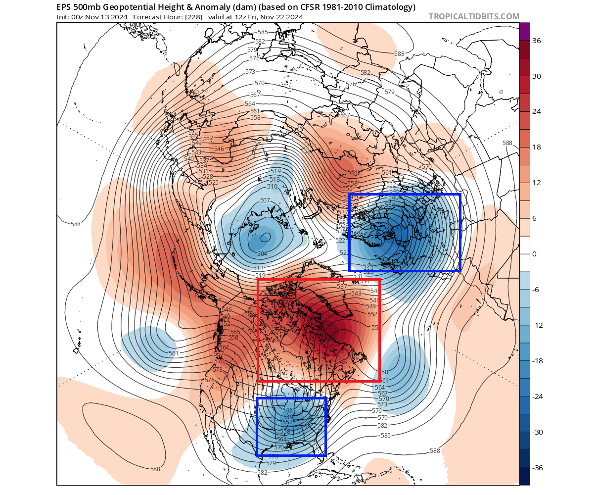
Such a blocking high area means a disruption in the jet stream flow, just like putting a big rock into the middle of a river. You can see low-pressure disturbances over the eastern United States and around the high-pressure area, like swirls in a river around a rock.
Below is the video animation, which shows the forecast of the pressure patterns. You can see how the high-pressure anomaly rises up into Canada and Greenland, with the low-pressure areas dancing around it.
Looking at the airmass temperature anomaly for the same period, you can see a broad area of below-normal temperature for this time of year. The strongest anomalies are forecast across the central and southern United States and over parts of the eastern U.S:
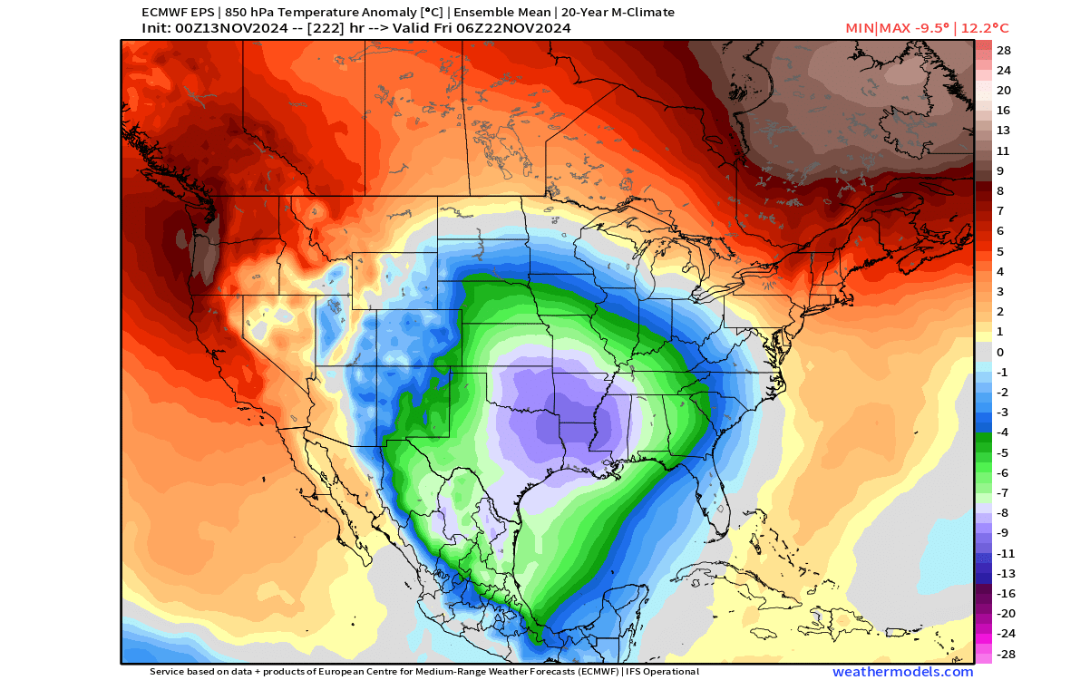
You can also see a warmer anomaly for the northeastern and northwestern United States. That has to do with the fact that the rotation of a low-pressure system is counter-clockwise in the northern hemisphere. With the low-pressure area over the eastern United States, that can mean a southerly airflow into the northeast.
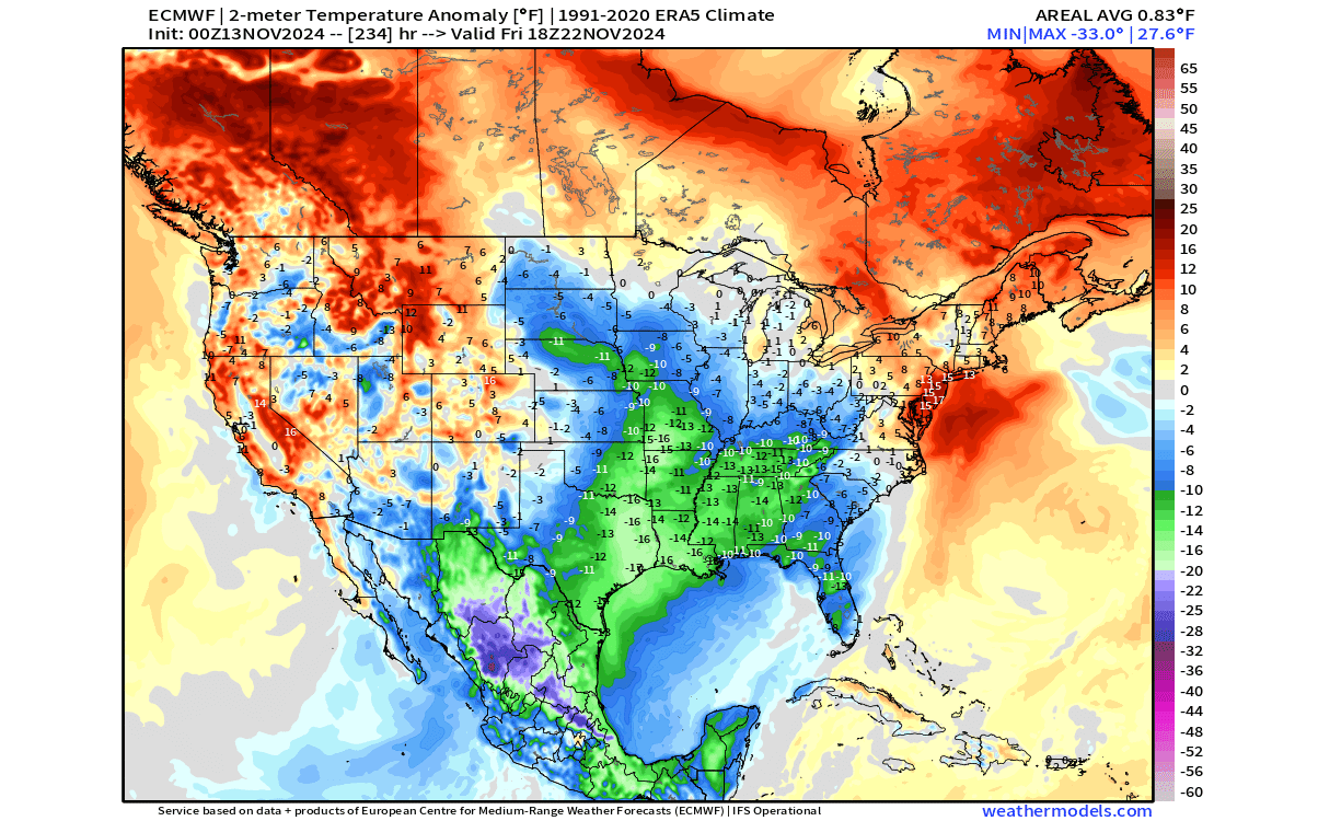
Looking at surface temperatures, you can see a negative anomaly across a large part of the central and eastern United States. The strongest anomalies reach -10 to -16 degrees below the normal values.
Below is the forecast for actual surface morning temperatures from the new prototype ECMWF AIFS model that uses AI technology for forecasting. It shows low temperatures ranging from 20 to 35 degrees F across a large part of the country. Areas across the Midwest and the plains are forecast to go below freezing.

With temperatures near zero, that increases the snowfall potential. Below is the total snowfall forecast, where you can see the snowfall areas in this first pattern shift. Apart from the Rockies, the largest snowfall area is currently forecast over the central and northern Plains and into the upper Midwest.
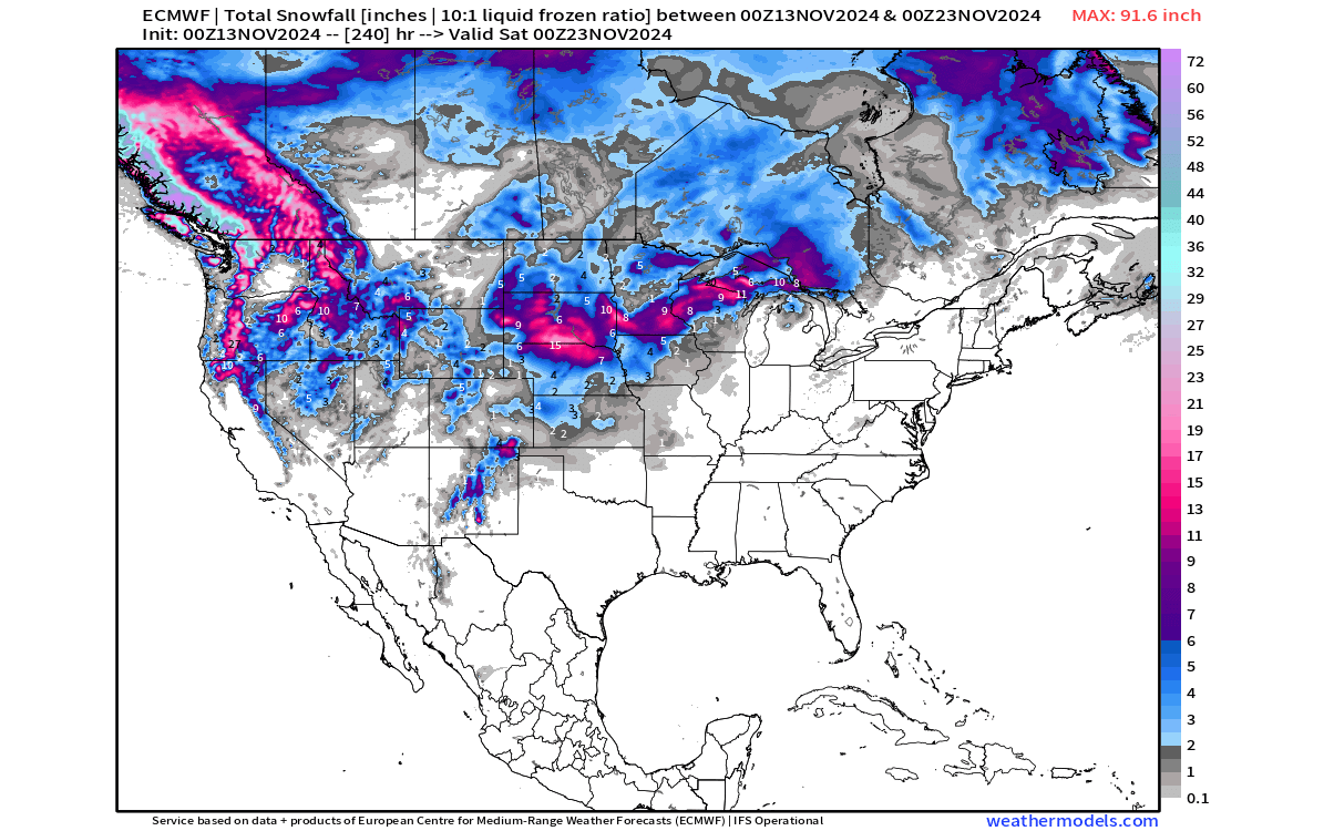
Another alternative is the NOAA blend of models, using different calculations to produce a forecast. You can see its total snowfall forecast below, for the next 10 days. It also shows the snowfall potential increasing across the Plains and the Midwest in the next 10 days as the patterns change.
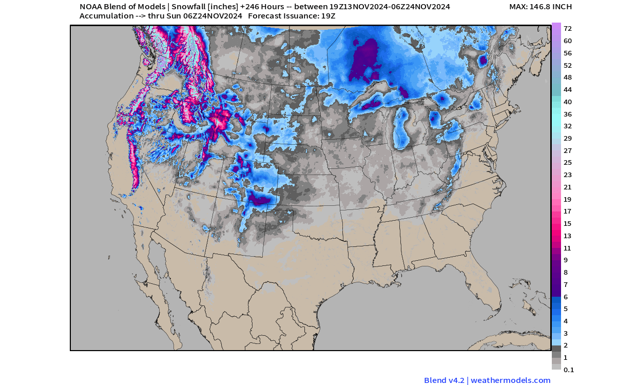
These forecasts only go out to 10 days, so we cant really reach into the second phase of this pattern shift with these models. But we will look at some snowfall trends in the next segment when we look further ahead at the evolution of this pattern.
Looking over Europe, we can see that the low-pressure area will bring a cold, northerly flow to the central and western parts, also increasing the snowfall potential across the area.
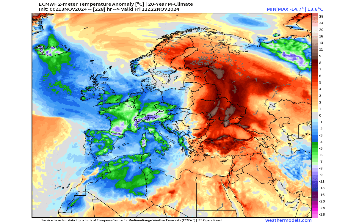
The total snowfall forecast shows this, with the snowfall potential increasing over the UK, Ireland, and the central and western parts of the continent.

WINTER PATTERN IN AUTUMN
November is the last month of meteorological Autumn, and with December, the meteorological Winter will begin. But will the weather patterns follow this shift?
Looking at the last days of November, we can see that the pressure pattern remains stable, with the blocking high-pressure area over Canada and Greenland. That keeps the low-pressure systems locked over the eastern United States and across the Atlantic, gradually moving towards the east.

You can see that on the temperature forecast for the same period. There is a broad cold airmass anomaly over the central and eastern United States. But as the low-pressure zone shifts to the east, the cold anomalies now reach deeper into the eastern United States.

The snowfall potential follows this slower motion trend, with snowfall areas also covering parts of the northeastern United States and deeper across the Plains.
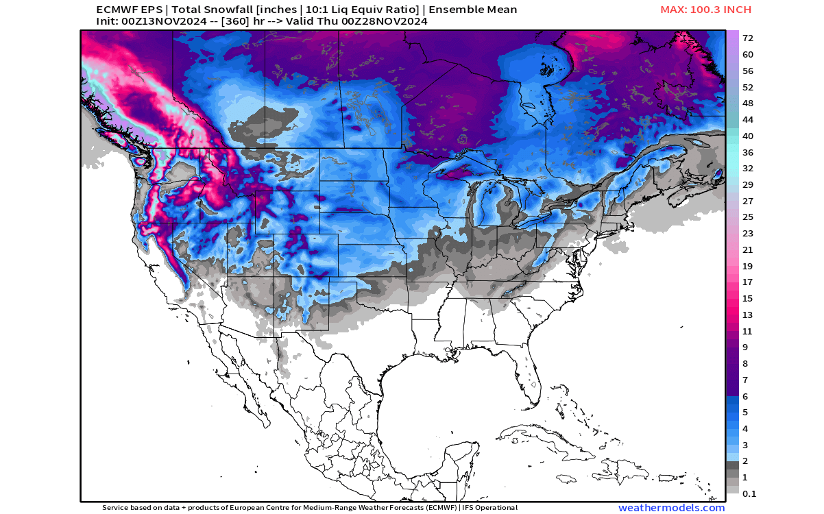
The forecast above is from an ensemble model that uses several different scenarios to create an average forecast. For that reason, the forecast might look a bit “smoother” as it’s an average of several different scenarios.
Looking at Europe, we can see a continued cold air anomaly reaching from the northwest down into the central parts. This is because of the counter-clockwise rotation of a low-pressure system, bringing down cold air on its western side and warmer air up on its eastern side.
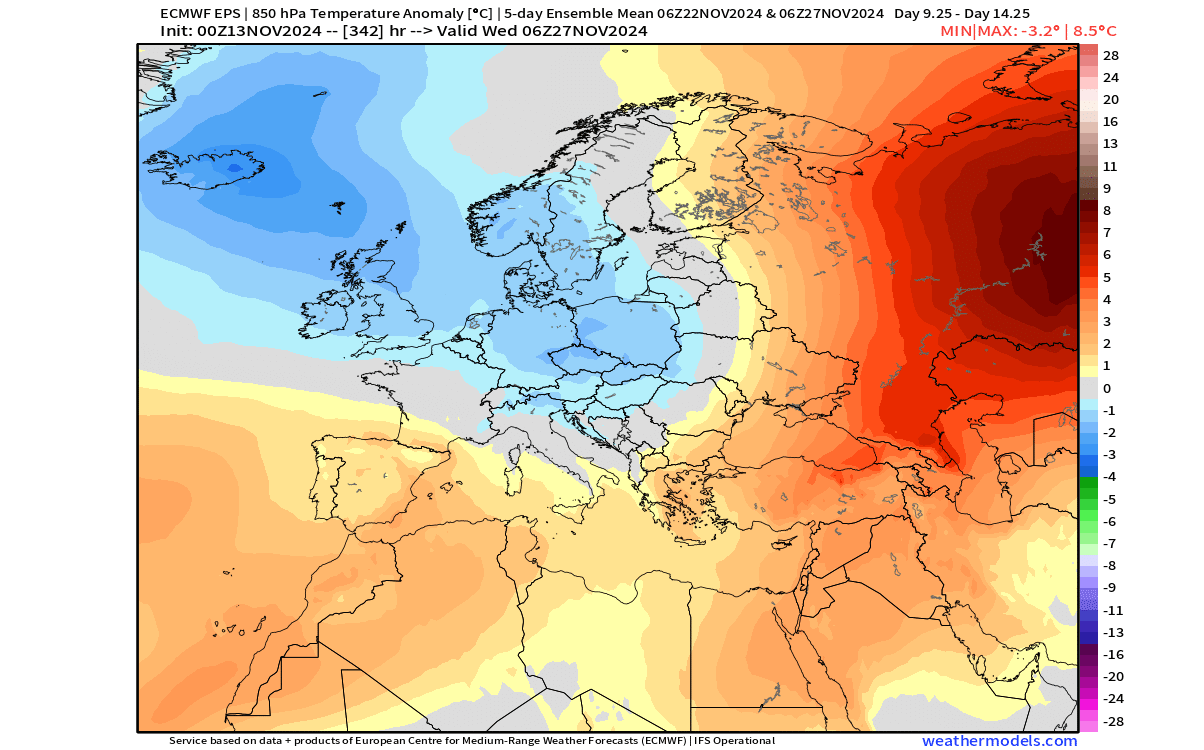
We don’t have snowfall data and images available for this range from the same model, but the snowfall potential in such a pattern is highest over the northern, northwestern, and central parts.
The images above are all 5-day averages, as that can show us prevailing weather trends and patterns. But below, we have the single-day pressure anomaly for the end of this forecast period. You can see the further shift of the pressure systems.

The main high-pressure system is forecast to start shifting west into Canada, while the low-pressure below shifts towards the east into the northeastern U.S. The low-pressure area over Europe is forecast to pull back up north.
This development can be seen in the temperature anomaly forecast, as the core of the cold air moves further out to the east, covering the eastern and northeastern United States to the end of the month.

Over Europe, we can also see the effects of the low-pressure area retreat. Warmer anomalies are forecast to return, at least briefly, into the western and central parts of the continent.

WEATHER IN DECEMBER
Early December is currently out of range for conventional forecasts, so we use the extended ensemble forecasts for this range. We mostly use the ECMWF extended forecast.
These forecasts are basically just a weather trend and don’t show a fixed scenario. Instead, we follow this forecast to see how it changes and what is the developing trend (warmer/colder over several different runs).
For the first week of December, the latest forecast trend shows a potential for a low-pressure system over the Midwest. We don’t see an actual low-pressure anomaly, but we do see a high-pressure area over the west and to the east, indicating a low-pressure area in between.
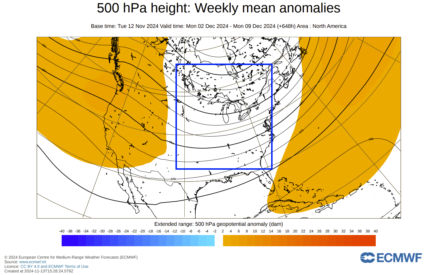
Looking at the temperature forecast for this period, we don’t really see an obvious cold area, as the forecast is too averaged out at this range. But we do see a large “normal” area across the central and eastern United States.
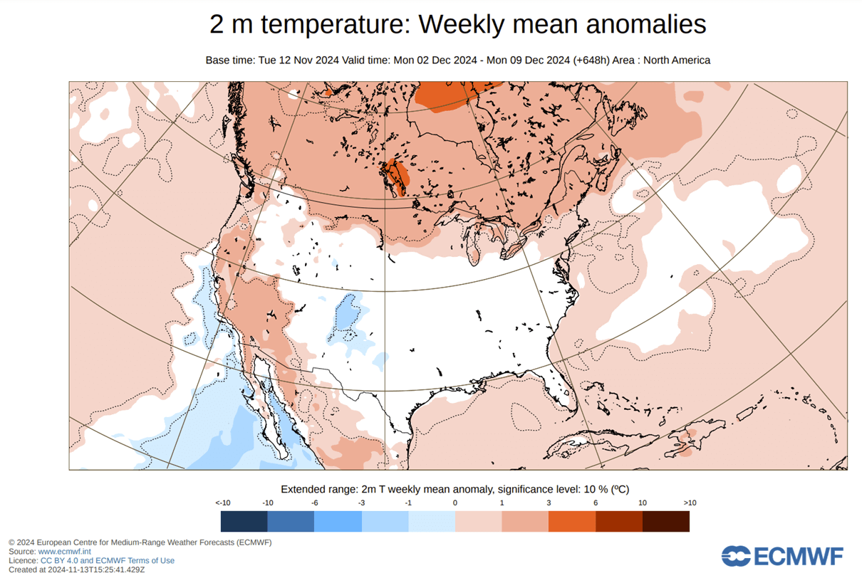
If there is a low-pressure area over the Midwest, we would expect to see an area of cold anomalies across the northern United States, into the Midwest, and over the Plains. That is due to the northerly flow on the back side of a low-pressure system pulling down colder air from the north.
Over Europe, we see a similar scenario of two high-pressure areas and a potential low-pressure area in between, covering the northwestern and north-central parts.
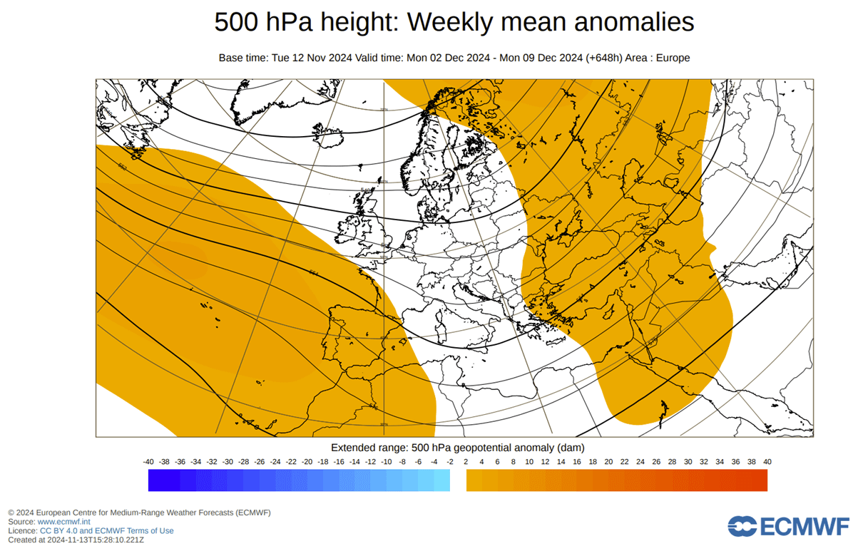
We also don’t see a proper cold air anomaly, but the absence of warm anomalies does show a potential route for cooler or colder air brought down by the low-pressure area. It extends from the northwest down into central parts.

If we were in late December or January, such a pattern would bring a long-lasting Winter period. As we are still in mid-late November, the overall cold and snow extent will be slightly lesser but will still reach over a larger area and bring very different weather than in the first half of this month.
We will keep you updated on the developing weather trends in the coming weeks, so make sure to bookmark our page. Also, if you have seen this article in the Google App (Discover) feed, click the like button (♥) there to see more of our forecasts and our latest articles on weather and nature in general.
Don’t miss:
Latest Winter 2024/2025 Snowfall Predictions: A Slow start but with a Late surprise